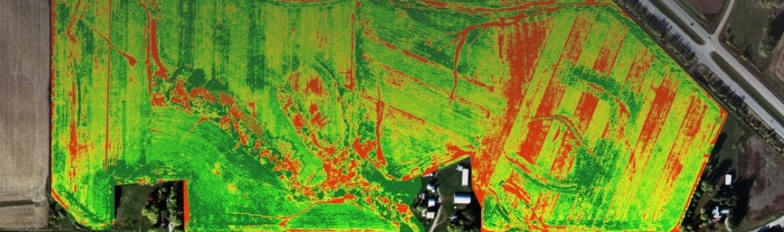
Jan 2016, Boulder, CO – In an article entitled High-Tech Analysis: Using Imagery to Build a Better Crop, GeoVisual’s CEO Jeff Orrey describes the path GeoVisual took to bring NASA-backed image analysis and mapping technologies to agriculture, and the opportunities that exist for imagery from satellites, drones and even smartphones to improve agricultural practices and crop health and yields.